Skip to content
Koh Phangan · Jungle Interior · Island Viewpoint

Dom Sila — Koh Phangan's Hidden Stone Dome
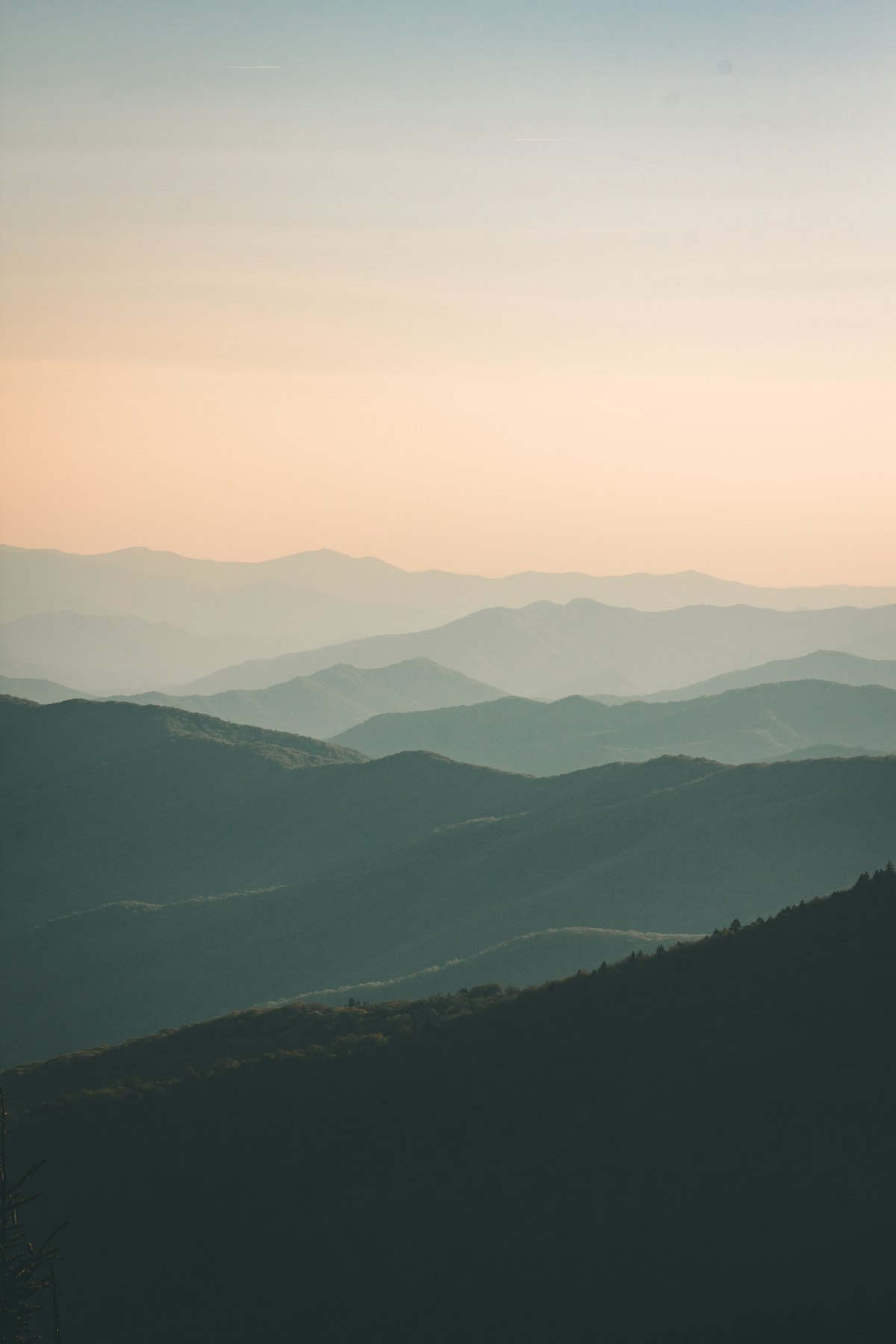
Dom Sila rocky viewpoint above the jungle interior of Koh Phangan

Dom Sila translates as 'stone dome' in Thai — an accurate description of the bare rocky formation that rises from Koh Phangan's forested interior to emerge above the treeline. The viewpoint opens across the island's palm-studded highlands, with glimpses of the coastline on a clear day, and almost none of the tourist infrastructure that lines every beach. The rocks and the view are often entirely to yourself.

It lies within the same national park corridor as Phaeng Noi Waterfall, a short distance along the trail from the falls. The two are natural companions for a morning in the island's interior — swim in the waterfall pool, then scramble up to the dome for the view, or reverse the order and descend to the water while the trail is still cool. Dom Sila adds minimal extra distance or time to a Phaeng Waterfall outing and repays the effort with a completely different experience: high, dry and wide open, compared to the cool shade and water below.

This page covers the viewpoint itself and what you can see, how to get there, the best way to combine it with Phaeng Waterfall and Khao Ra, and when to come for the clearest skies.

What to know about Dom Sila

Stone dome rock · Above the canopy · Palm-studded interior panorama

The viewpoint — above the treeline with open interior views

Dom Sila — 'stone dome' in Thai — is a natural rocky formation that rises from the forested highland interior to emerge above the treeline, giving open views across Koh Phangan's jungle interior and, on a clear day, glimpses of the coastline through the canopy. The elevated rocky outcrop is what gives the spot its character: you are standing on bare stone above the jungle, looking out at a landscape almost entirely free of roads, buildings and the usual markers of a tourist island. Because it sits off the main waterfall trail and most visitors focus on Phaeng Noi below, Dom Sila is rarely crowded — the rocks and the view are often entirely to yourself. A rope rail helps on the steepest section of the final approach. The experience is unlike any beach on the island: quiet, high, and entirely in the trees.

All viewpoints on Koh Phangan →
Short scramble · Slippery after rain · Grip shoes essential

Getting there — the trail from the national park

Dom Sila lies within the same national park corridor as Phaeng Noi Waterfall, reached by trail from the national park entrance. The approach is significantly less demanding than the Khao Ra summit hike — it requires a short scramble over uneven terrain rather than a long ascent, and most reasonably active visitors can reach it without difficulty. Like all interior trails, the path turns slippery after rain; grip-soled shoes are the only sensible footwear and sandals or flip-flops are genuinely unsafe over wet rock. A rope rail assists on the steepest final section. Carry water, go in the morning before the heat builds, and bring cash for the national park entry fee at the gate. The trail is well within reach of a half-morning out from any base on the south or east coast.

Hiking on Koh Phangan →
Same national park corridor · Waterfall swim first · Minimal extra distance

Combining with Phaeng Noi Waterfall — the natural pairing

The most natural way to visit Dom Sila is as part of a Phaeng Noi Waterfall outing — the two sit within the same national park corridor and are easy to combine in a single morning. The usual order is waterfall first: descend to the tiered cascades, swim in the cool natural pool at their base, then follow the trail across and up to Dom Sila for the viewpoint. You can also reverse the order — rocky viewpoint while the trail is driest, then down to the pool. The combination gives you the full range of what the island's forested interior offers: water, shade, swimming and a genuine high-up view of the landscape, all in a few hours without needing a guide or a particularly early start.

Phaeng Waterfall guide →
627 m summit · Full-day effort · Both coasts from the top

How it compares to Khao Ra — the bigger challenge

Khao Ra, at 627 metres the island's highest peak, is the more demanding option for visitors wanting a genuine summit experience. The ascent takes one to two hours through dense jungle, gains significant elevation, and on a clear day opens to a panorama that includes both the east and west coasts simultaneously — something no other viewpoint on the island can match. Dom Sila is far less demanding: a short scramble rather than a long climb, a interior-and-coastline view rather than a dual-coast panorama. The two occupy different places on the difficulty scale. Dom Sila is the right call for a half-morning outing or for visitors who want interior views without a full-day commitment. Khao Ra is for anyone determined to reach the island's highest point and see it whole.

Khao Ra hike guide →
Viewpoints & nearby activities

Dom Sila and the island interior

All viewpoints →

Viewpoint & jungle guides

Koh Phangan viewpoints compared

Dom Sila is one of five distinct ways to get above the treeline on Koh Phangan — each with a different effort level, route, and view. Here is how they stack up to help you choose the right one for your visit.

Koh Phangan viewpoints — Dom Sila vs Khao Ra, Phaeng Viewpoint, ridge road & Bottle Beach headland
ViewpointEffortRouteViewBest for
Dom Sila (here)Easy scrambleShort trail from the national park entrance near Phaeng Noi Waterfall; rope rail on the steepest section; no guide neededPalm-studded forested interior across Koh Phangan's highlands; glimpses of the coastline through the canopy on clear daysHalf-morning outings; combining with Phaeng Noi Waterfall swim; interior views without a full-day commitment
Khao Ra (627 m)Challenging — 1–2 hrs upTrail through dense tropical forest from the central highlands; gains significant elevation; local guides available and recommended on first visitThe only spot on the island where both the east and west coasts are visible at the same time on a clear day; full Gulf of Thailand panorama from the summitDedicated hikers; clear early-morning starts; anyone who wants the island's highest point and its most complete panorama
Phaeng ViewpointEasy — short climb from the waterfallFollows the same trail as Phaeng Noi Waterfall; the path continues past the falls to the ridgeline; short drive from Ban Tai or Thong SalaWide south-coast panorama; forested interior sloping down to the sea; the most attainable view on the islandFamilies; first-time jungle visitors; south-coast travellers who want a waterfall swim and a ridge view in one outing
Thong Nai Pan ridge roadNo hiking — scooter or taxi onlySteep switchback road over the island's central ridge to Thong Nai Pan on the northeast coast; natural pull-offs along the way for stoppingIsland interior from the ridge; the northeast coast and the horseshoe of Thong Nai Pan bay spread out below as you descendNon-hikers; scooter day-trippers heading to or from Thong Nai Pan; anyone who wants scenery without physical effort
Bottle Beach headlandModerate — short steep trailSteep path from the beach up to the headland above Haad Khuat; almost everyone who arrives by longtail from Chaloklum makes the climb before settling on the sandFull horseshoe arc of Haad Khuat bay below; surrounding jungle hills; open Gulf of Thailand and distant islands on clear daysVisitors already at Bottle Beach; pairs naturally with the longtail boat journey from Chaloklum; rewards a short effort with a striking aerial bay view

Trail conditions vary with season and recent rain. Go early before the heat builds; grip-soled shoes are essential on all the walking options.

Dom Sila Viewpoint, answered

Where is Dom Sila Viewpoint on Koh Phangan?
+
Dom Sila Viewpoint is in the forested highland interior of Koh Phangan, a short distance from Phaeng Noi Waterfall within the island's national park area. There is no airport on Koh Phangan — you arrive by ferry into Thong Sala pier, then reach the national park entrance by scooter or taxi from the south coast. Dom Sila and Phaeng Noi Waterfall sit in the same national park corridor, so visitors typically reach both in the same outing.
Is Dom Sila Viewpoint difficult to reach?
+
No — it is one of the more accessible viewpoints on the island. The trail from the national park entrance is shorter and less demanding than the Khao Ra summit hike, and it requires a short scramble over uneven terrain rather than a long mountain ascent. A rope rail assists on the steepest final section. Most reasonably active visitors can reach it without difficulty. Grip-soled shoes are essential, as sections of the trail become slippery after rain.
What can you see from Dom Sila?
+
Dom Sila opens above the treeline and gives views across Koh Phangan's palm-studded forested interior. On a clear day you can see glimpses of the coastline through the canopy. The viewpoint offers interior and partial coastal views rather than the full both-coasts panorama available from Khao Ra summit. The experience is a wide, open outlook over jungle from a bare stone rock formation — very different from the beach and sea views that most of the island's visitors come for.
When is the best time to visit Dom Sila?
+
The dry season — roughly November to April — gives the most reliable trail conditions and the clearest views. Go early in the morning before the heat builds; the interior cools slowly once the sun is fully up. In the wet season (May to October) the trail can become very slippery, and the ridge and interior may be partly in cloud. Even in the dry season, afternoon cloud can build up in the highlands, so a morning visit gives the best chance of clear sightlines from the rock.
Can you combine Dom Sila with Phaeng Waterfall in the same outing?
+
Yes — this is the most natural way to visit both. Dom Sila lies within the same national park corridor as Phaeng Noi Waterfall, so combining them adds minimal extra distance or time. The usual approach is to reach the waterfall first for the swim while the pool is coolest, then follow the trail across to Dom Sila for the viewpoint scramble. You can also reverse the order. Allow a morning for both and plan to be back at the trailhead before midday heat peaks.
Do you need to pay to visit Dom Sila?
+
Dom Sila sits within a national park and a park entry fee applies at the gate — the same fee covers the Phaeng Noi Waterfall trail within the same corridor. Bring cash, as card payment may not be available at the entrance. Check the current fee locally before you go, as it can change.

More jungle & outdoor adventures

Live · weather & clocks

Koh Phangan

HQ

Thailand

--:--:--

–°

Berlin

Germany

--:--:--

–°

New York

USA

--:--:--

–°

Bali

Indonesia

--:--:--

–°

Sydney

Australia

--:--:--

–°